City App with Geolocation - Edge1S

Development of a Mobile App with Geolocation and Gamification for Lubelscy Kupcy

Lubelscy kupcy mobile case study mockup illustration

Project at a glance

Client: Lubelscy KupcyIndustry: Retail / CommerceService:Dedicated TeamArea: Mobile Application / Android / iOS

Edge One Solutions supported Lubelscy Kupcy by providing IT expertise responsible for developing a mobile solution supporting digital transformation and improving communication between businesses and their customers.

The project included creating a mobile application designed to provide convenient access to information and services, developing user-oriented functionalities, and delivering a scalable solution adapted to the needs of local commerce.

Tools and technologies used

  • Android SDK
  • Google Maps API
  • Gamification Engine
  • Firebase
  • Challenge

    The goal of the project was to create an application that encourages users to explore the city through physical activity and interaction with its history. The application needed to combine education with entertainment in an accessible and engaging format, so that users would not only read about the history of Lublin but experience it in specific locations across the city.

    A key challenge was to use the map and the user’s location to guide them through places connected with the history of local merchants and the city’s former commercial structure. These included locations such as former hairdressing salons, textile shops, and historic shopping arcades.

    Another important challenge was maintaining user engagement. Historical content alone might not be enough to keep users motivated, so the application needed to include points, competition, ranking, and gamification mechanisms that encourage users to complete the route.

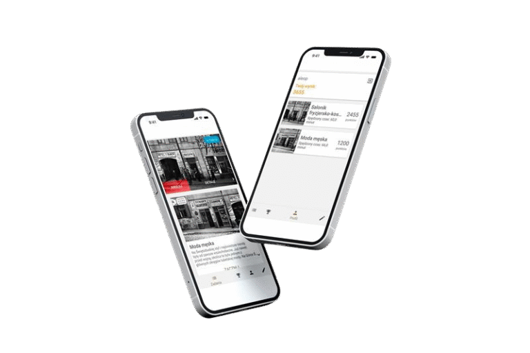
    Lubelscy Kupcy mobile app illustrations, two mobile phones with Lubelscy Kupcy app screenshots
  • Scope of work by Edge One Solutions

    Edge One Solutions supported the development of a mobile application combining city game mechanics, geolocation, and historical education.

    The scope of work included:

    • development of a mobile application based on user location,
    • use of a map to guide users along a historical route,
    • implementation of tasks assigned to specific points on the map,
    • activation of tasks after the user reaches the correct location,
    • implementation of a points system,
    • development of a participant ranking mechanism,
    • use of time and location as elements of task evaluation,
    • implementation of hints and historical descriptions,
    • combining educational content with a light entertainment format,
    • use of Android SDK, Google Maps API, Gamification Engine, and Firebase.

    Scrum and iterative software delivery process illustrated on a laptop.
  • Solution

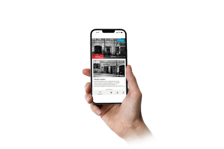
    The Edge One Solutions team created a mobile application that guides users through a historical route and engages them in completing field tasks. Users can log in, select a route, and follow the hints provided by the application.

    Tasks are assigned to specific points on the map and are activated when the user reaches the correct location. As a result, the application is not a static guide, but an interactive city game in which urban space becomes part of the user experience.

    The solution includes a participant ranking showing points and user progress. The evaluation system takes into account both the time and location of task completion — the faster and more accurately the user completes a task, the more points they can earn.

    The application also includes hints and descriptions that present local history, architectural style, and the former functions of selected buildings in an accessible way. This allows users to gain knowledge in a natural context — while walking through the city and interacting with real locations.

    Lubelscy Kupcy mobile app illustration, mobile phone with a Lubelscy Kupcy app screenshot
  • Project significance for the public sector, education, and tourism

    City applications based on geolocation can effectively combine education, tourism, and physical activity. Instead of presenting history only as text, they can guide users through real places, activate tasks in specific locations, and build engagement through gamification mechanisms.

    For public institutions, museums, tourism organizations, and cities, this format can be a modern way to tell local stories. A mobile application becomes not only a guide, but an interactive educational tool that engages users in the space where the story actually took place.

    The Lubelscy Kupcy project shows how mobile technologies, maps, geolocation, and gamification can support the promotion of local heritage and create more engaging experiences for residents, tourists, and participants in educational initiatives.

    Rozwiązania IT dla sektora publicznego

Entrust your project to our experts!

Fill out the form
How Much Does a Legacy System Really Cost? 7 Hidden Costs That Don’t Show Up in the IT Budget

A legacy system can run reliably and still become increasingly expensive. Explore 7 hidden costs to consider before deciding whether to maintain, modernize, or replace it....  read more

How much does a programmer earn? Programmer salaries in 2026

Find out how much a programmer earns in various positions and countries. An overview of programmer salaries in Poland, Germany, the USA, and other regions for 2023....  read more

AgentOps in the Enterprise: How to Manage AI Agent Permissions, Memory and Actions

How do you control AI agents in production? Explore AgentOps: identity, permissions, memory, human approval, audit and mechanisms for limiting agent actions....  read more